

Summary: Severe storms and prolonged heavy rain have driven the White River and tributaries to record levels across central Indiana, prompting mass evacuations, hundreds of rescues and at least five confirmed deaths. State and federal emergency teams are coordinating response and recovery as communities assess damage and begin cleanup.
What happened
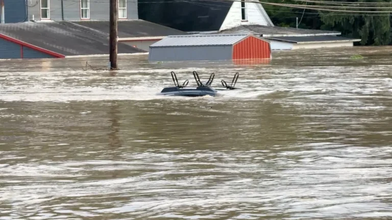
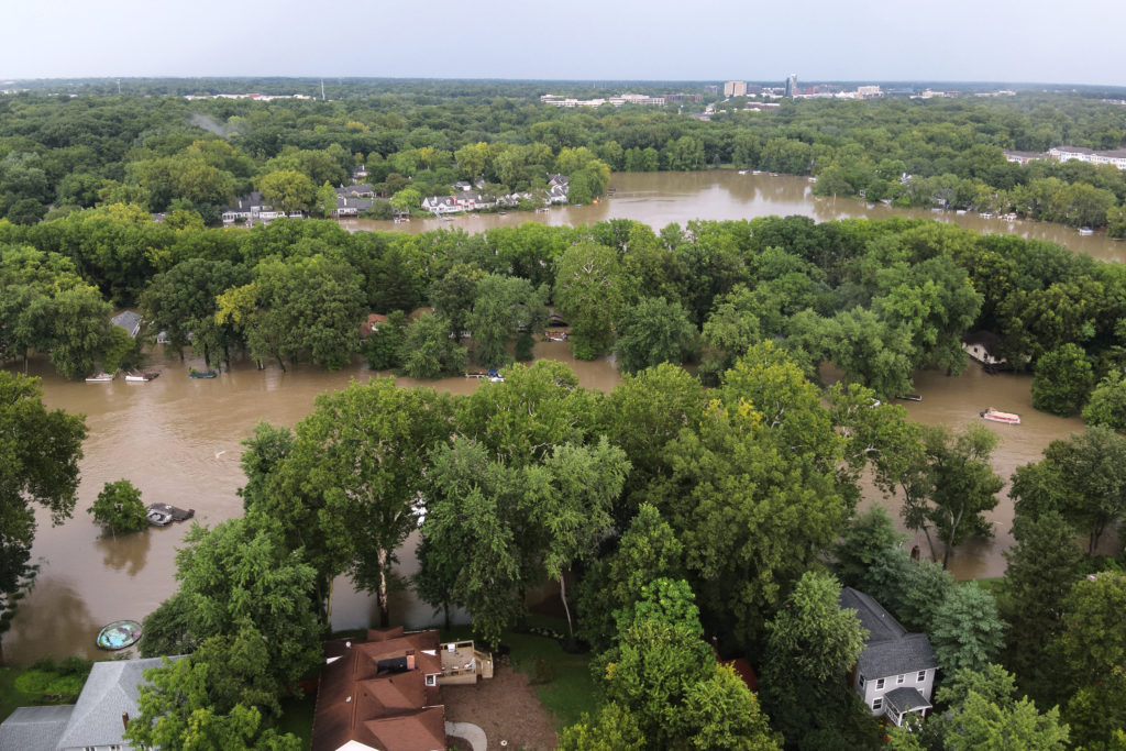
Over the past week, intense storms dumped unusually large amounts of rain across central Indiana, pushing rivers and creeks well beyond flood stage. In many areas the rainfall came in a short window — with some locations receiving more than 11 inches over two days — sending water rushing downstream and causing the White River to crest at historic heights in communities including Anderson, Noblesville and the Indianapolis metro area.
First responders used boats to evacuate neighborhoods along river corridors, and dozens of road closures and power outages were reported. Local officials said more than a dozen counties declared local disasters. State officials reported at least five people had died in storm- and flood-related incidents, including a child killed when a tree fell on a home and instances of people swept into floodwaters.
Response and rescue efforts
Indianapolis Mayor Joe Hogsett described the event as the city’s most severe flooding in more than 30 years, urging residents to heed evacuation orders and avoid floodwaters. Local fire and emergency management agencies reported dozens of water rescues — including dozens of people and pets pulled from rising water — and the National Guard and state resources were deployed to assist where needed.
President Donald Trump approved an emergency declaration for Indiana, making federal disaster assistance available to affected areas. Federal Emergency Management Agency (FEMA) teams have been preparing to help coordinate recovery resources, in partnership with state and local agencies.
Human toll and local impact
Officials reported evacuations in counties along the White River corridor and rescues across Marion, Hamilton, Delaware, Tipton and Fayette counties. In Noblesville, the river’s historic crest left homes, streets and public spaces under water; some upstream communities similarly suffered washed-out roads, toppled power poles and submerged properties.
While some areas are beginning to see floodwaters recede, flash-flood warnings and watches remained in place across central Indiana as rivers move through their peak stages.
Context and causes
Flooding of this scale is driven by a combination of meteorological and hydrological factors. Repeated rounds of heavy rain over upstream watersheds can send large volumes of water downstream faster than rivers and floodplains can absorb or channel it, producing rapid rises in river levels. Urban development and impervious surfaces in and around metropolitan areas can worsen runoff, and aging drainage and stormwater systems may be overwhelmed in extreme events.
Scientists also note that a warming atmosphere holds more moisture, increasing the potential for intense rainfall events. While a single flood event is the result of short-term weather patterns, long-term trends in rainfall intensity and flooding risk have been linked to broader climate changes.
What comes next — recovery and assistance
Immediate priorities for affected communities include search and rescue, restoring critical utilities, opening shelters and providing short-term housing and food assistance to displaced residents. In the weeks and months ahead, communities will work with state and federal agencies to assess structural damage, clear debris, repair infrastructure and evaluate long-term mitigation — such as buyouts of repeatedly flooded properties, improvements to drainage and levees, and updated land-use planning.
FEMA and state emergency management offices typically publish guidance and resources for individuals and communities seeking assistance. Local governments also often coordinate cleanup and contractor resources to help homeowners start repairs.
Safety guidance for residents
- Do not drive or walk through floodwaters — six inches of moving water can knock a person down and one foot of moving water can sweep a vehicle away.
- Heed evacuation orders and use designated shelters if provided by local officials or relief organizations.
- Avoid flooded areas and be cautious of downed power lines and contaminated water.
- Document damage with photos for insurance and disaster assistance claims, and keep records of expenses related to the event.
Analysis: Preparing for future extremes
This event underscores the importance of investing in resilient infrastructure, improved floodplain management, timely early-warning systems and community preparedness. As extreme rainfall events become more common in many regions, policymakers and planners face pressing decisions about where to rebuild, how to bolster drainage and levees, and when to consider buyouts or relocation for properties in recurrent flood zones.
Long-term resilience will require coordinated federal, state and local planning, updated building codes and targeted funding for mitigation projects that reduce the human and economic cost of future floods.
Sources
- The Associated Press — coverage of Indiana flooding, rescues and fatalities.
- Federal Emergency Management Agency (FEMA) — information on disaster declarations and federal assistance programs.
- National Weather Service (NWS) and NWS Advanced Hydrologic Prediction Service (AHPS) — river forecasts, crests and flood warnings.
- The Indianapolis Star — local reporting on neighborhood impacts and evacuations.
- American Red Cross — flood safety and preparedness guidance.
- NOAA Climate.gov — context about links between a warming climate and extreme precipitation.
- State of Indiana (official site) — state announcements and resources for residents.
Reporter note: This summary synthesizes official statements and local reporting to provide an overview of the event, response and recovery implications for impacted Indiana communities.