



Midweek Forecast: Frontal Boundary vs. Gulf Tropical System
Across Florida, two competing features are dictating weather headlines: a slow-moving frontal boundary lingering to the north and a developing tropical system in the Gulf of Mexico. That combination can mean largely pleasant weather in some places, locally heavy downpours in others, and the potential for a rapid change if the front or tropical system shifts faster than expected.
Current pattern and short-term expectations
The stalled front north of South Florida has kept the main corridor of steady rain and cloud cover farther inland, while south Florida has generally experienced partly cloudy skies with occasional high clouds. However, when the atmosphere becomes sufficiently moist with southwest or westerly steering flow, scattered to intermittent downpours — sometimes intense — remain possible in interior and coastal areas.
Where the front stalls and how far it sags south will be the primary factor for whether late-week rainfall increases across the peninsula. Expect warm, muggy mornings with increasing convective activity (showers and thunderstorms) through the afternoon and evening, especially where outflow boundaries or sea-breeze collisions occur.
The tropical threat: what to watch for
When a tropical depression forms in the Gulf, the National Hurricane Center (NHC) will issue frequent updates on its intensity and forecast track. Key elements to monitor:
- Intensity trends: A tropical depression can strengthen quickly if wind shear is low and ocean heat content is high. The NHC issues wind speed forecasts and probabilities for strengthening.
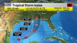
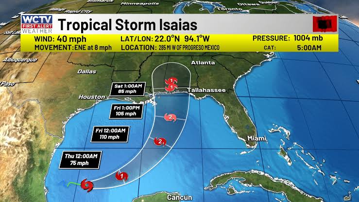
- Track forecast and cone: Initial eastward motion followed by a northward turn can place a system toward the upper Gulf Coast; small shifts in track can dramatically change which coastline sees the worst impacts.
- Hazards: Wind, heavy rainfall and flash flooding, coastal storm surge and dangerous surf are the main hazards to coastal and near-coastal communities.
For the latest official advisories and forecast cones, consult the National Hurricane Center: https://www.nhc.noaa.gov.
How forecasters interpret the interaction: front vs. tropical system
The outcome hinges on the synoptic-scale steering flow (mid- and upper-level winds) and the position of the frontal boundary. If the front remains north, the system is more likely to recurve away from the Florida peninsula. If the front slides south or is weak where the tropical system approaches, the system could hug the coast or make landfall along the northern Gulf states.
Forecasters use ensembles and high-resolution models to estimate the likelihood of different scenarios, but uncertainty is inherent — particularly 72+ hours from landfall. Stay current with NHC updates and local National Weather Service offices for watches and warnings: https://www.weather.gov.
Potential impacts for Florida residents
- South Florida: Mostly dry to scattered showers if the front stays north, but be prepared for sudden localized downpours and brief flooding where storms train or stall.
- Central to North Florida and the Panhandle: Higher risk for heavier rainfall, sustained winds, coastal flooding and surge if the tropical system turns northward as forecast by some guidance.
- Marine interests: Dangerous seas, squalls and rapidly deteriorating conditions are possible; mariners should heed small craft advisories and any tropical marine warnings.
Preparedness checklist
Even before a watch or warning is issued, residents in potentially affected areas should:
- Review and update a family emergency plan and make sure everyone knows evacuation routes and communication plans.
- Secure loose outdoor items and trim dead tree limbs that could become projectiles in strong winds.
- Top off fuel, check flashlights, batteries and have a basic emergency kit (water, nonperishable food, medications) on hand.
- Sign up for local alerts via your county emergency management and monitor official social channels for real-time guidance: Florida Division of Emergency Management.
For federal preparedness resources including guidance on hurricane readiness and recovery, consult FEMA’s hurricane pages.
Where to get authoritative, real-time information
- National Hurricane Center (track, forecasts, tropical cyclone advisories): nhc.noaa.gov
- National Weather Service local offices (warnings, forecasts, local impacts): weather.gov
- NOAA Weather Radio for continuous official updates: weather.gov/nwr
- Local emergency management for county-level instructions and shelter information, e.g., Florida Division of Emergency Management: floridadisaster.org
Bottom line
The combination of a lingering front and a developing Gulf tropical system creates a high-uncertainty weather environment for Florida. While much of south Florida may remain mostly dry in the near term, the threat of sudden downpours is real. Areas farther north and along the upper Gulf coast should monitor forecasts closely and prepare for tropical impacts if the system strengthens and turns northward. Keep monitoring official sources and finalize preparedness plans now rather than waiting for the last-minute alerts.
Sources: National Hurricane Center, National Weather Service, NOAA, Florida Division of Emergency Management, FEMA.